

By Sara Beth Williams–
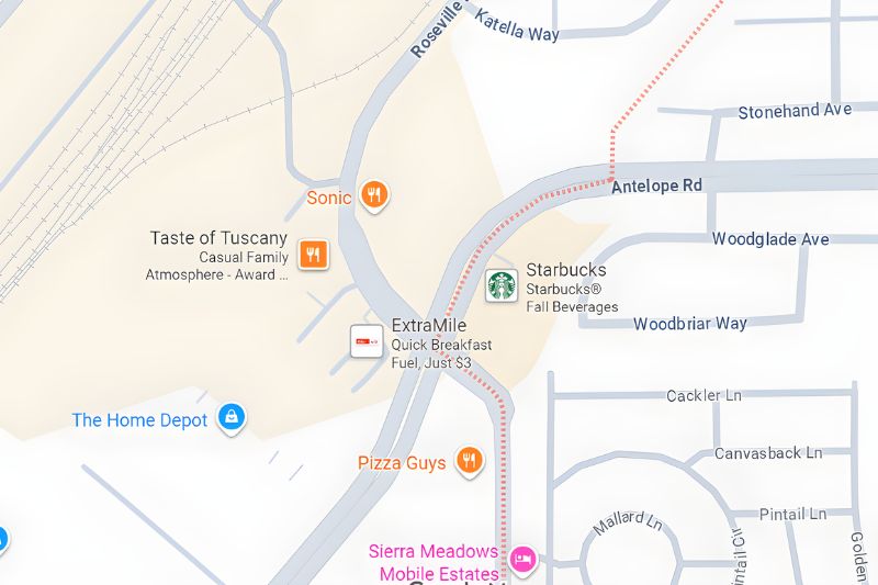
With the recent grand opening of a new Sonic Drive-In restaurant alongside a new ARCO gas station on the corner of Antelope Road and Roseville Road, some have questioned why the two new businesses have Citrus Heights postal addresses.
The prominent corner, which sees up to 50,000 vehicles pass through, and its surrounding neighborhoods and commercial districts are technically located outside of Citrus Heights’ boundaries, according to Google Maps and other sources.
Online maps of Citrus Heights show the city boundary line ending just after Stonehand Avenue, before the corner of Antelope Road and Roseville Road, where both ARCO and Sonic are situated.
In contrast, the businesses located on the southeastern corner, at Antelope Road and Daly Avenue, are within city limits, but have Sacramento addresses, such as the Starbucks, located inside Citrus Heights, with an address of 5874 Antelope Rd., Sacramento, and Pho Yung Tau Bay restaurant, at 5880 Antelope Rd., Sacramento.
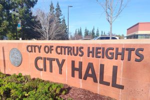
In a statement, the City of Citrus Heights confirmed that Sonic and ARCO both fall just outside of the city’s boundary lines, and referred all other related questions to the United States Postal Service postmaster.
The Postmaster was not able to be reached for comment before press time, but according to the US Postal Service website, a business located just outside Citrus Heights may still fall under the same zip code as the city, leading to an address that appears to be within the city limits. This is due to the post office’s efforts to ensure efficient mail delivery.
The US Postal Service does have a zip code boundary Review Process to consider municipal requests to modify authorized last lines of address or zip code boundaries to achieve municipal identity, the postal service website shows.
The question of whether certain businesses or residential areas have been assigned the right address in accordance with jurisdictional boundary lines has occurred in the past, with multiple readers questioning why Handel’s Homemade Ice Cream was given a Citrus Heights address when it appears to be located in Fair Oaks.
Related: Q&A: Is the new Handel’s Ice Cream in Citrus Heights or Fair Oaks? – Citrus Heights Sentinel
In the case of Handel’s, half of the Almond Orchard shopping center, including the ice cream shop, resides in Citrus Heights, while the other half resides in Fair Oaks, according to Google Maps images. In the case of Sonic and ARCO, both businesses have Citrus Heights addresses but do not reside in the city limits.
So why do the two new businesses still have Citrus Heights addresses?
The corner and its surrounding residential and commercial areas have been the subject of talks of annexation in years past, with former Mayor Bret Daniels calling it an “oversight” at having left out several residential neighborhoods at what is known as Roseville Pointe.
During an initial study of annexation, where the city spent several months looking into whether annexing several sections of the city would be financially feasible, the city found in 2022 that annexing every area, including Roseville Pointe, would result in negative financial impacts to the city, according to a staff report from an Aug. 13 City Council meeting.
During that August City Council meeting however, the city again proposed revisiting annexation of a section of commercial and residential areas located at the corner of Madison Avenue and Fair Oaks Boulevard that is located just outside Citrus Heights in Fair Oaks, an unincorporated part of Sacramento County.


