



By Sara Beth Williams–
A small building with a long overhang situated along the busy Auburn Boulevard corridor in between Manzanita Avenue and Greenback Lane was once known as the 12 Mile House, an historical way station that served as a resting place for travelers along the historic Lincoln Highway corridor between the foothills and Sacramento.
The 12 Mile House way station, located at 5919 Auburn Blvd., also operated as a general store, saloon and restaurant. The building was named the “12 Mile House” because it sat roughly 12 miles from downtown Sacramento, then known as Sutter’s Fort, along the historic wagon and stagecoach routes.
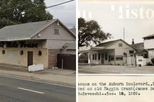
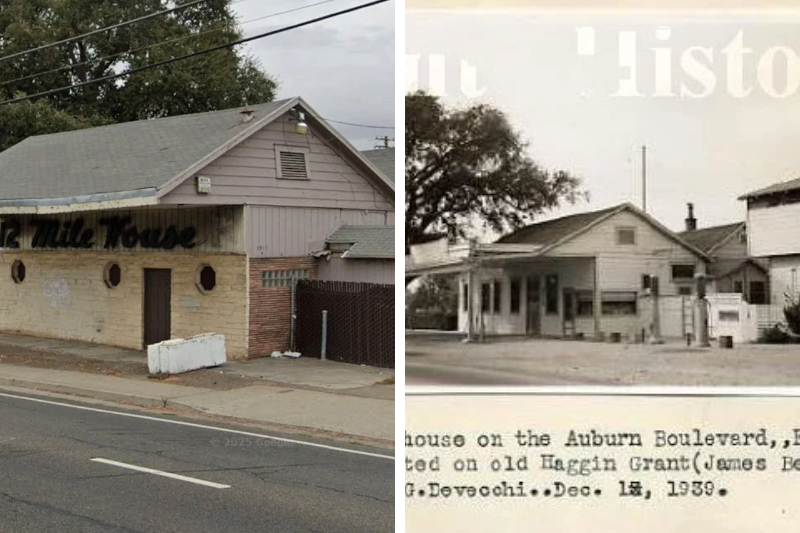
Today the 12 Mile House, which has its title written across the front of the building, is visibly dilapidated. The small building has been used as a storage shed for years, according to the current property owners, who own a total of four parcels of land adjacent to each other including the plot of land which houses the 12 Mile House.
A representative of Jake’s Towing and Recovery who did not want to provide their name, says they have owned the property which includes the 12 Mile House for several years and declined to disclose who the prior owners of the property were between 1998 and the time they took over.
Historical records show James and Ann Devecchi operated a restaurant and bar beginning in the 1930’s. Sometime around World War II, they decided to add a dance floor and turn the operation into a full-fledged night club. The business continued under other ownership until 1998, the Historical Society says.
Allegedly the property has changed hands several times since then. The Sentinel could not verify the number or names of previous owners of the land.
“The Auburn Road Mile Houses did a lively business for 15 years,” the Historical Society says, adding that traffic was diverted from the corridor when the first transcontinental railroad was completed in the mid-1860s.
Although not exactly a mile apart, the roadhouses were called the 12, 14, 15, 16, 17 and 18 Mile Houses, the Historical Society states on its website. One of the way stations, the 18 Mile House near Old Auburn and South Cirby Way, was also known as the “Half-Way House” because it was 36 miles between Sacramento and Auburn.
The Mile Houses defined the east and west side of Sylvan, or what is now Citrus Heights, Historical Society President Larry Fritz says, adding that they were built directly on the edge of the road.
The 12 Mile h0ouse served as the western most way station, while the 18 Mile House served as the eastern most way station, located at Old Auburn Road and Cirby Way.
The city’s historical resources survey says the original 12 Mile House from the Gold Rush era was not the same building as the one standing today. It describes the current building as likely dating from the 1920s or 1930s.
Sacramento County parcel records indicate the current building was constructed in 1920, though there is some speculation by historians that indicate it may have been originally constructed in the later 1800s. It’s unknown whether it was rebuilt or simply remodeled.
Lillian Cross, who authored the historical manuscript Sylvan Recollection: A History of the Sylvan District, Sacramento, County, California in March 1943, theorized that the building which sits abutting Auburn Boulevard took on the name of a former 12 Mile House, and that the original building was constructed closer to where Auburn Boulevard would have been located before being rerouted.
A 1939 photo of the 12 Mile House shared with The Sentinel by the historical society shows that the property also contained a water tower, and gravity fed gas pumps. Fritz said it would have also had a well, as there weren’t water pipes.
The 12 Mile House is one of two that served Auburn Boulevard, including the surviving 14 Mile House located at 6540 Auburn Blvd. that once served 19th century teamsters and travelers heading toward the Sierra foothills. The 14 Mile House has been extensively remodeled, and also recently sold, according to previous reporting.
Roadhouses 16, 17 and 18 followed the route of Old Auburn Road when Auburn Boulevard was split and rerouted to travel north.
Historical records indicate there was a possibly short-lived 13 Mile House, which burned down and was not rebuilt. The Historical Society said it does not know where it was located.